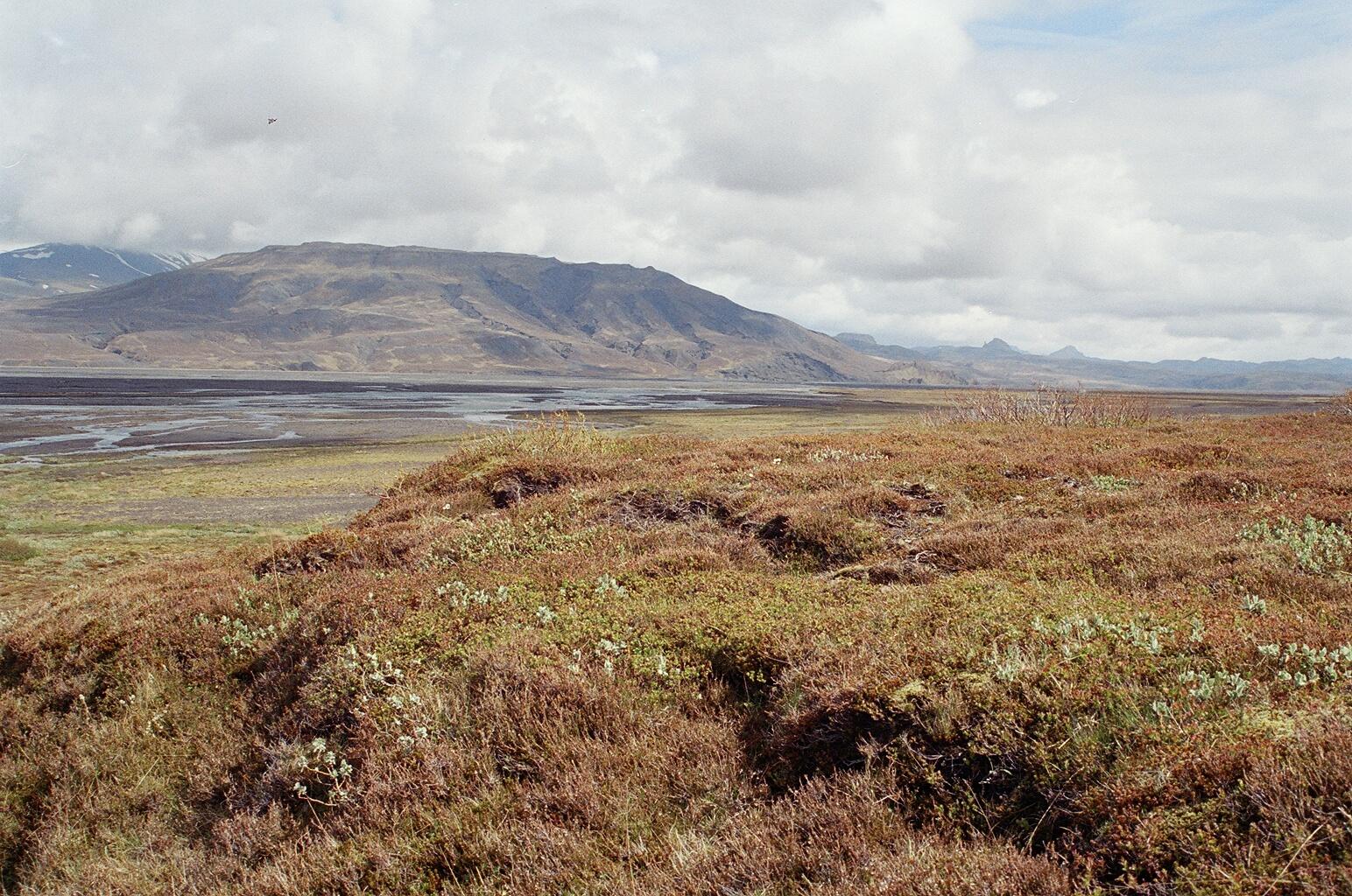
Breathtaking view of Mýrdalsjökull, Tindfjallajökull, and Eyjafjallajökull.
Þórólfsfell and Mögugilshellir
Thórólfsfell is a 574 m. high tuff mountain, partially covered with coarse ash from the Hekla eruption of 1947 and with fine ash from the Eyjafjallajökull eruption of 2010. Mentioned in the Book of Settlement, it is the place where Njáll from the Legend of Njáls Saga had a farm, although no remains of the farm are visible today.
The view from the top of Thórólfsfell is breathtaking with a view of three glaciers- Mýrdalsjökull, Tindfjallajökull, and Eyjafjallajökull. From Fljótsdalur, a hike can be taken to the top of Thórólfsfell. 4×4 cars can cross the Thórólfsá River, but smaller cars must be left at the public car-park at the signboard. Pedestrians can cross the river using the footbridge. (Note- this is the only place to cross the river without having to wade across.) Follow the river, always keeping it to your left, and cross the boundary fence by the wooden stile.(steps) Then follow the sheep path by the gorge which leads to an embankment of rough gravel, and from there take the grassy slopes to the summit which is marked by a cairn. It is worth walking to the eastern edge to get better views into the interior. The round trip hike takes approximately 4+ hours.
2-3 km south of Thórólfsfell lies Mögugil Ravine, with its outstanding tuff rock formations. A short walk into the ravine brings you to Mögugilshellir Cave. The walls of this 15 meter long cave are covered with blue-veined rock formations, created either by gas or air pressure bubbles coming up from within the earth.
Situated in Thórólfsfell in Fljotshlið, this natural cave is well known both by locals and by cavers. The cave is 15 meters long and the walls are covered with blue-veined rock formations, having been created either by gas or air pressure coming up from within the earth. The cave’s opening is situated in a gorge called Mögugil, through which a little brook runs and because of the proximity of the brook to the opening, the cave filled with water nearly 30 years ago. 15 years ago, farmers in the area made a parking lot by the gorge and partially dug out the cave. Six meters of the cave were cleaned out and then a 1.5 meter high wall was erected as a barrier to help protect it from flooding. This barrier was swept away however, during the winter and the cave filled with water again. The city council of Rangarthing-eystra has decided to clean out the cave once again. The opening has been dug out, enabling people to crawl into the upper cave. It is closed in winter.
Celebrating Earth Heritage
How to visit the Katla Geopark
Katla UNESCO Global Geopark is in central South Iceland