Magnificent and massive canyon
Fjaðrárgljúfur
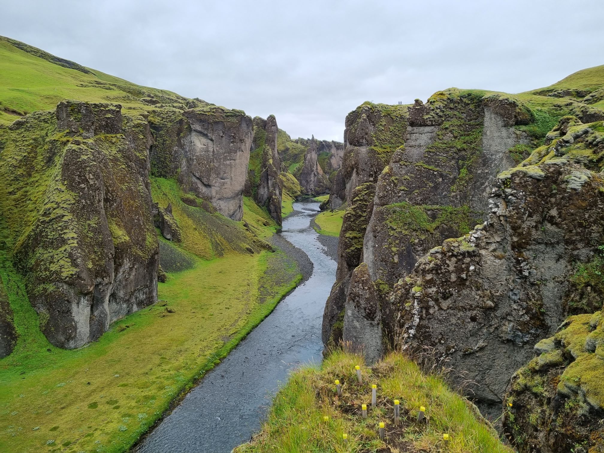
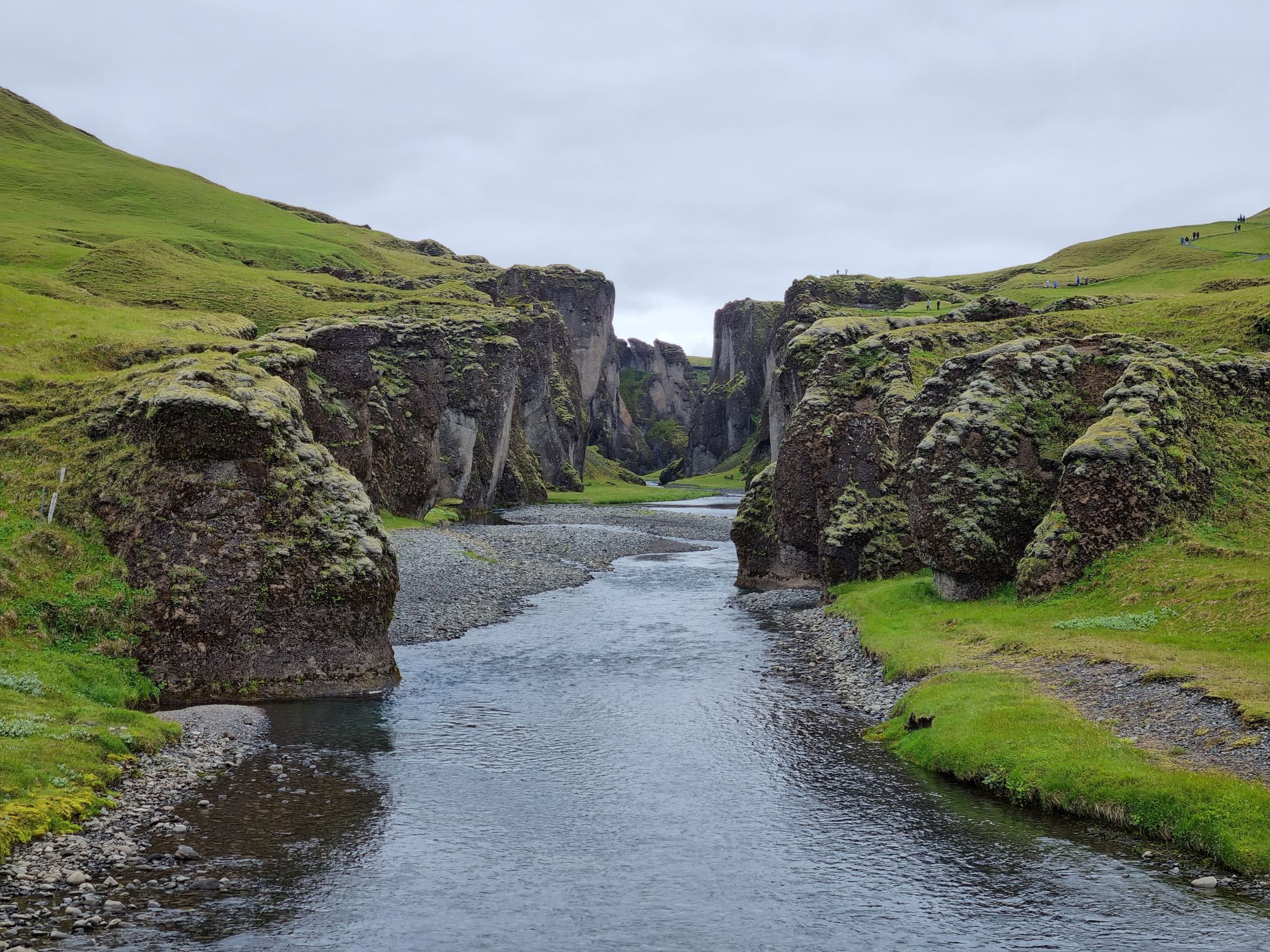
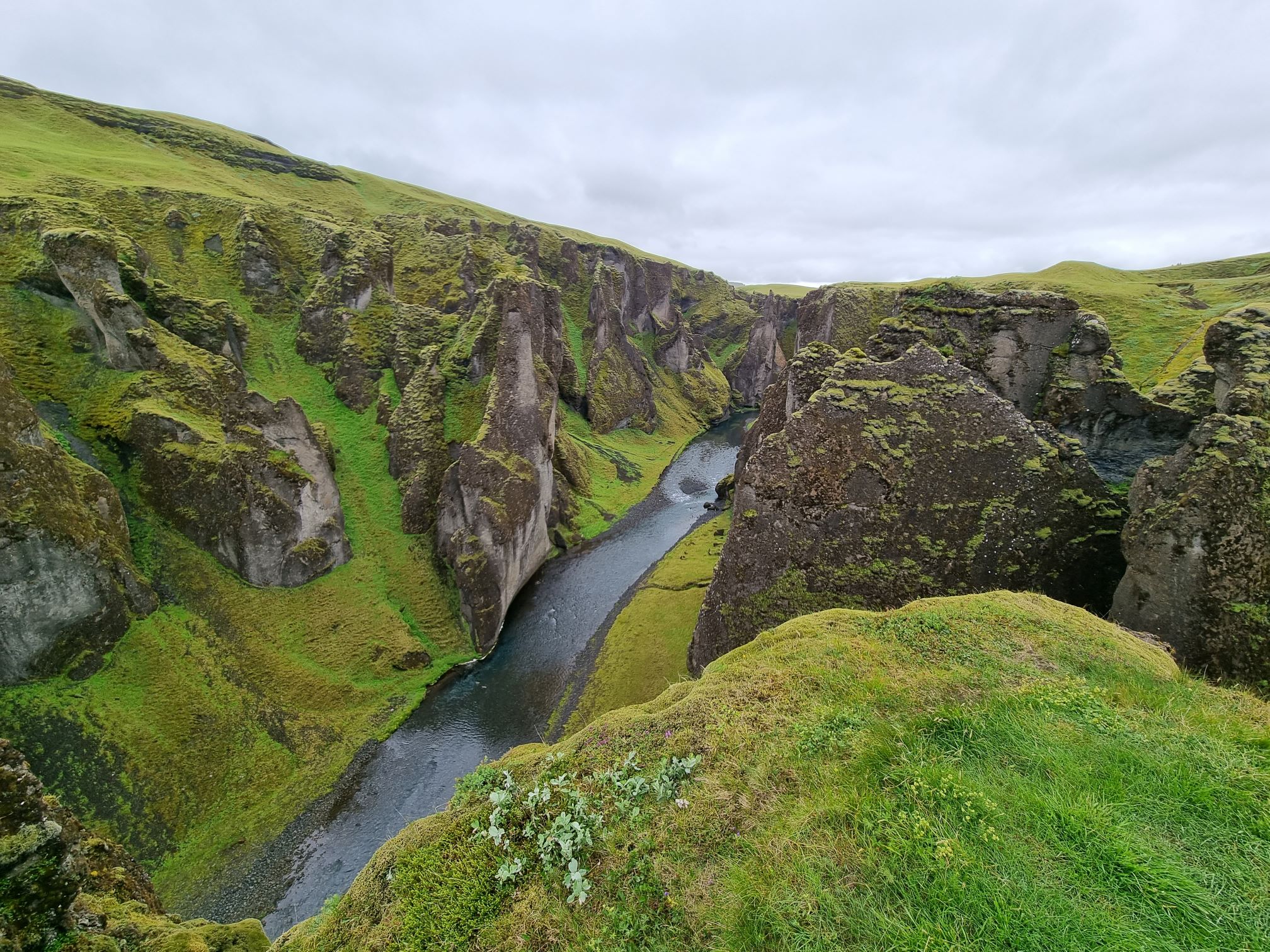
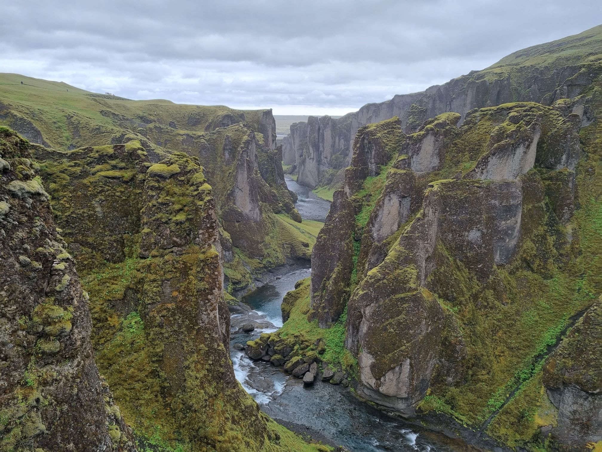
Fjaðrárgljúfur is a magnificent and massive canyon, about 30 meters deep and about two kilometres long. The canyon has sheer walls, and is somewhat serpentine and narrow. The bedrock in Fjaðrárgljúfur is mostly palagonite from cold periods of the Ice Age and is thought to be about two million years old. The river Fjaðrá has its source in the mountain Geirlandshraun and falls off the heath edge in this stunning canyon until it makes it down into Skaftá river. Fjaðrá has changed a lot in the course of time. Deep in the canyon there are waterfalls so one needs to walk the same way back. Take the walking path up on the canyon’s edge while simultaneously enjoying the view above the canyon. Due to important breeding grounds, hiking up the canyon along or in the river is strictly forbidden.
Formation of the Fjaðrárgljúfur canyon
It is believed that Fjaðrárgljúfur formed at the end of the last Ice Age, about nine thousand years ago. When the glacier retreated, a lake formed in the valley behind a hard resistant rock. The run-off from the lake flowed to where Fjaðrárgljúfur is today. Glacial rivers from the glacier’s edge carried a lot of sediment into the lake and the river which ran from it dug itself down into the rock and down onto the palagonite in front of it. Because the cascade has been so large, it was powerful in digging out the canyon. Eventually the lake filled with sediments and the river’s strength dwindled. When the lake filled up completely, the river began to dig itself into the sediment layers which it had previously left in the valley. Fluvial terraces on both sides in the valley give an indication about the original height and location of the lake while a deep channel in the palagonite serves as a silent reminder to the power of nature.
How do I get to there?
Fjaðrárgljúfur is located around 4 kilometres from the turn off the ring road. If you’re driving eastward along the ring road, you can see a sign on your left hand saying Fjaðrárgljúfur. Drive for a couple of minutes until you reach the parking lot.
Is it accessible for all kind of cars?
Under normal conditions yes.
Is the hike difficult?
The hike is relatively short and easy.
Can I go there in the wintertime?
Yes. Check the weather forecast prior to visiting. Dangerous conditions can form during winter due to heavy snows, slick surfaces or other situational conditions.
Is there entrance fee?
No entrance fee.
Is it OK to step outside the fenced off areas?
No. It can be EXTREMELY dangerous to walk near cliff edges. Going off the path can harm the fragile vegetation growing in the area. Always follow markings and paths and do not step over ropes or fences, they are there for a reason.
Celebrating Earth Heritage
How to visit the Katla Geopark
Katla UNESCO Global Geopark is in central South Iceland