It is possible to walk around behind Seljalandsfoss
Seljalandsfoss, Gljúfrabúi
Seljalandsfoss
Seljalandsfoss waterfall is in Seljalandsá river, which originates from the western side of Eyjafjöll mountain range. The waterfall is about 62 meters high and has formed a pool underneath itself which is called Kerið (the Tub), where both sea char and sea trout can be spotted. Seljalandsfoss falls from old sea cliffs, but the cliffs were formed during and after the end of the last glaciation during the Ice Age, when the relative sea level was much higher than it is now. During that time, waves eroded into the Eyjafjöll mountain range and formed the cliffs, but since then the relative sea level has dropped and the lowlands have formed in front of the mountain range, and therefore the sea cliffs are now far inland. The cliffs themselves at the waterfall are made from a few rock layers, where the layer at the top of the waterfall is a beautiful layer of lava, while below the cliff is mostly made of palagonite tuff and breccia, with various grain sizes, and often with a beautiful layering and different colors. It is therefore ideal to also admire the cliffs when you visit the waterfall, even though the attraction of the waterfall is undoubtedly much greater for most people.
Gljúfrabúi
The waterfall Gljúfrabúi tumbles down from the Gljúfurá River. Its source is just north of Tröllagil (Troll Gorge) Canyon in the heath Hamragarðaheiði. It is a spring-fed river and less voluminous than its neighbour Seljalandsá River. The river runs from Tröllagilsmýri (Troll Gorge Marsh), a picturesque and fertile marsh in the heath. When the river emerges out of the marsh, it runs into the northern edge of a lava field which was formed in the volcanic eruptions in Eyjafjallajökull at the beginning of Holocene. There are several little waterfalls to be found in the river in the area.
Gljúfrabúi, which is 40 m tall, is on the land of the uninhabited farmstead Hamragarðar which the Rangá Foresty Society received as a gift in 1962 and is now owned by the municipality of Rangárþing eystra. There is a certain mystique over the waterfall because it falls into a deep chasm, while in front of it there is much palagonite rock that blocks the waterfall so that only the very top of it is visible. The boulder that blocks the waterfall is called Franskanef. Previously, people believed that it and the surrounding cliffs were the residences of huldufólk or hidden people. It is possible to take off your shoes and wade the river down in the canyon. It’s an amazing experience. Caution must be taken when travelling in the canyon because there is a risk of falling rocks. There is an old bath basin below Franskanef and at the inner end of the basin there is a little cave called Ömpuhellir, named after a hermit woman who lived there. Gljúfrabúi is a protected natural monument.
Celebrating Earth Heritage
How to visit the Katla Geopark
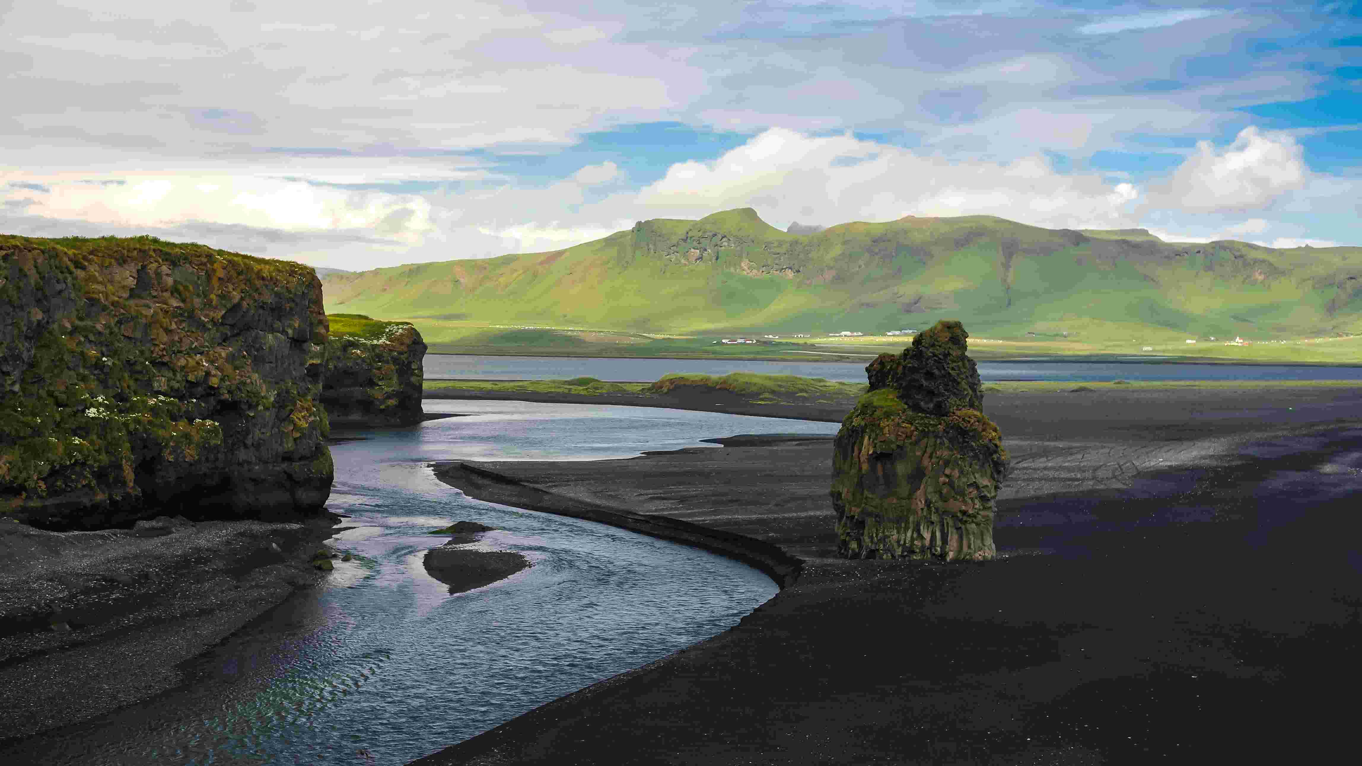
Katla UNESCO Global Geopark is in central South Iceland