International Mountain Day in 2024
The International Mountain Day (https://www.un.org/en/observances/mountain-day) is celebrated on the 11th of December. Every year, to celebrate the day, the geopark publishes a short article about one of its favourite mountain, and in 2024 it was Mt. Sandfell in Skaftárhreppur Municipality.
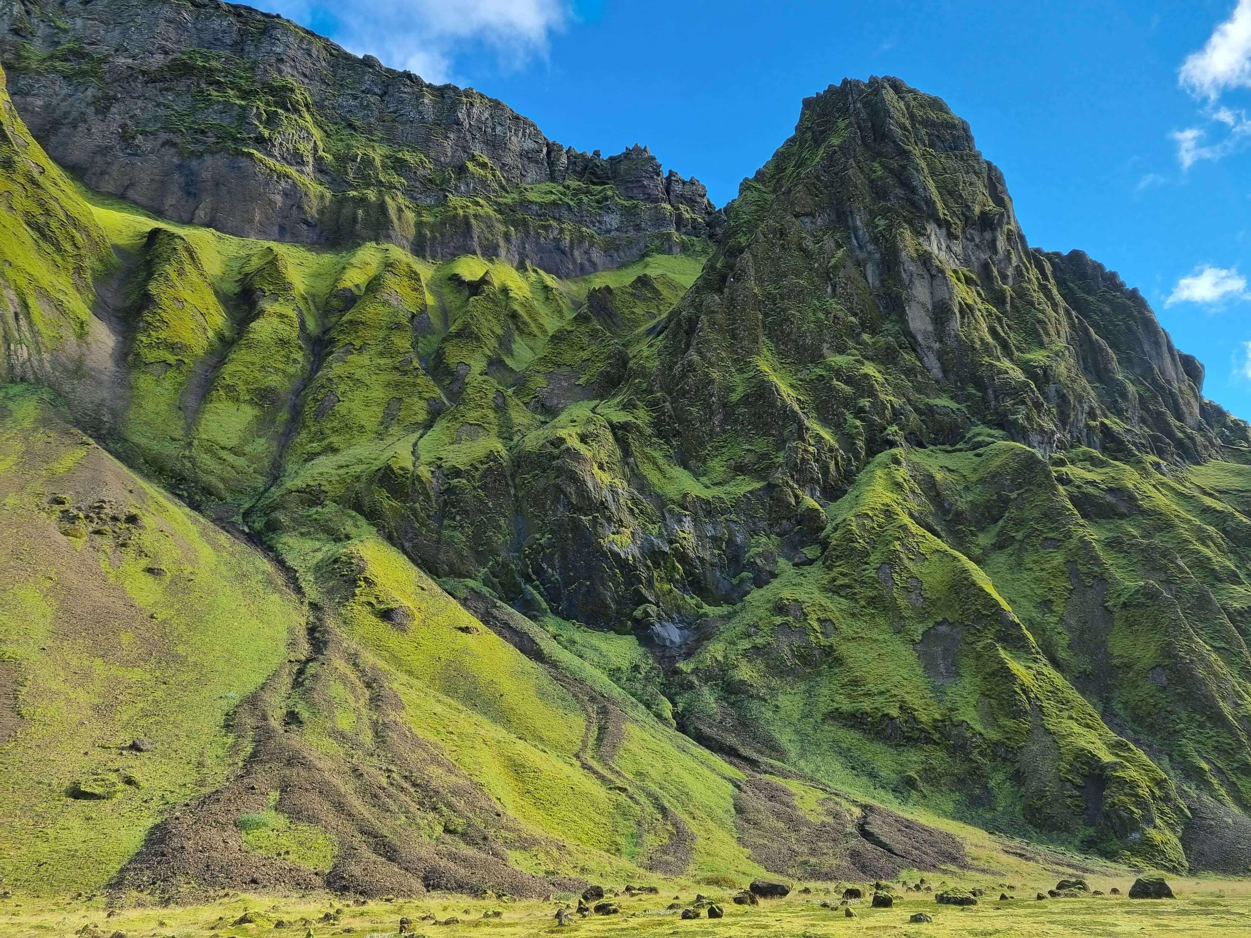
Mt. Hafursey is an exceptionally beautiful tuya in the middle of Mýrdalssandur sand plain. The mountain was formed in an eruption under a glacier and/or in the sea during the second half of the ice age, and tuyas like Hafursey are common within Katla Geopark. Pillow basalt normally forms at the bottom of them when there is still deep water (meltwater from the glacier) or sea above the eruption vent. As the eruption carries on the depth of the water or the sea decreases, allowing explosive eruption to start which shatters the magma into tephra. If the eruption continues and water is no longer able to get to the eruption vent, lava will start to flow and covers the upper part of the tuya. There is a lot of beautiful geological formations on and around the mountain, and the palagonite tuff rock is especially beautiful as it tends to be eroded into curious shapes.
The age of Hafursey is not known, as the mountain has not been studied scientifically, and it is also not known if the mountain was formed in one or more eruptions. The mountain is divided by Klofgil canyon, and the western part is called Skálarfjall (582m) and the highest point is Kistufell (513m) on the eastern part. The mountain is to the east of Kötlujökull outlet glacier, from where most of the glacial outburst floods have come due to eruptions in Katla during the last 1200 years. Glacial outburst floods have undoubtedly eroded large parts of the mountain, but they have also built up the sand plain around the mountain. Mýrdalssandur is about 120 m thick all around the mountain and beautiful sand dunes from the black sand have formed on the northern side of the mountain. It is not only glacial outburst flood that have eroded Hafursey, as glaciers have had a great impact on the mountain as well and the sea was likely able to reach it right after the end of the last glacial period.
Shelter for travelers has been in Hafursey for a long time, as the road over Mýrdalssandur passed by it, and was therefore a refuge for many travelers who passed through there. The current shelter is in a small valley on the southeast edge of the mountain, and the remains of a small sheep corral and an older shelter are nearby. There are also two remarkable caves, Sel and Stúka, in the southern part of the mountain, but in the 1755 eruption of Katla, six men sought shelter there during the eruption. They wrote the date, year and their initials on the rock wall that faces you when you look inside. That is not the only time that the mountain has saved people, as during the eruption and the following glacial outburst flood in 1660, several people sought refuge in the mountain. It is also likely that the mountain has saved people in the past from the wrath of Katla.
The mountain can be seen from a large area and is very beautiful, especially during summer when vegetation covers its slopes. There is also a large fulmar colony in the mountain and its sides have a lot of low-lying bushes, but there used to be a rather dense forest there. The mountain was a good grazing ground for animals and farmers from Hjörleifshöfði let their cattle and sheep graze there all year round. No one will therefore be disappointed by visiting Hafursey, but the view in all directions from there is spectacular and the golden nature all around.
Celebrating Earth Heritage
How to visit the Katla Geopark
Katla UNESCO Global Geopark is in central South Iceland