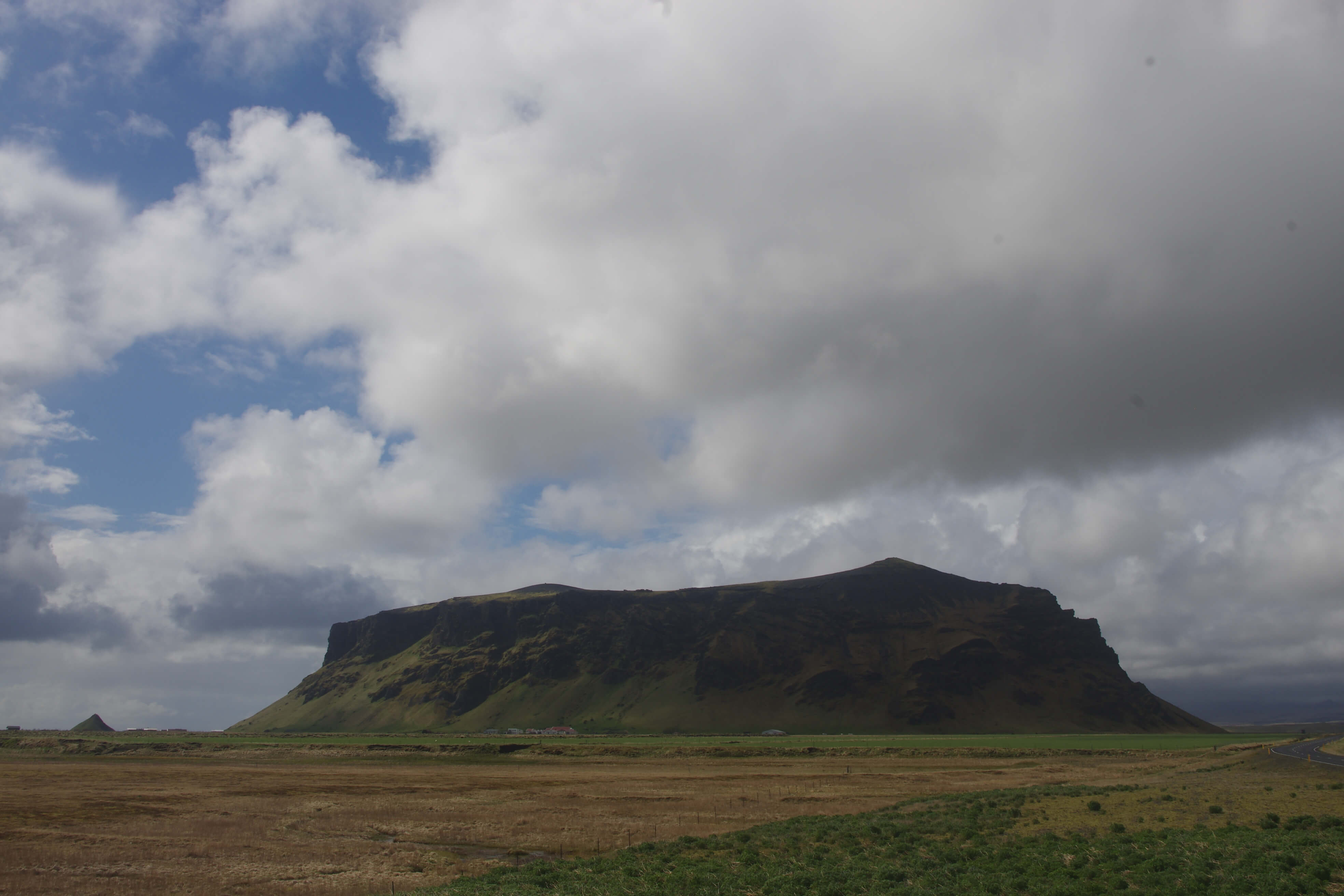
275m high tuff mountain south of Mýrdalsjökull glacier
Eyjarhóll, Pétursey
Pétursey (i.e., Peter’s Island) is a 275 m high tuya that was formed in a subglacial and/or submarine eruption. The tuya has been dated to have formed about 113 thousand years ago, at the end of the last interglacial period or at the start of the last glacial period. South of Pétursey is Eyjarhóll, which is a conical grass-covered knoll.
The knoll has been formed due to erosion of Pétursey and was probably a sea stack when the relative sea level was higher at the end of the last glacial period, but Pétursey is now far inland due to changes in sea level and deposition from glacial rivers. The island was originally called Eyjan há (i.e., the high island) but was later changed, possibly in honor of the apostle Peter, but there could be a different reason. The farm Pétursey once had a church, but by the 13th or 14th century the priest had moved to the nearby farm of Sólheimar.
An unmarked trail runs from the west side of the island and up it on the southwest side, and the view from there is very good. The cave Eyjahellir is close to the trail and it's fun to have a look inside there.
Celebrating Earth Heritage
How to visit the Katla Geopark
Katla UNESCO Global Geopark is in central South Iceland