Lakagígar is a 27 km long eruptive fissure
Lakagígar
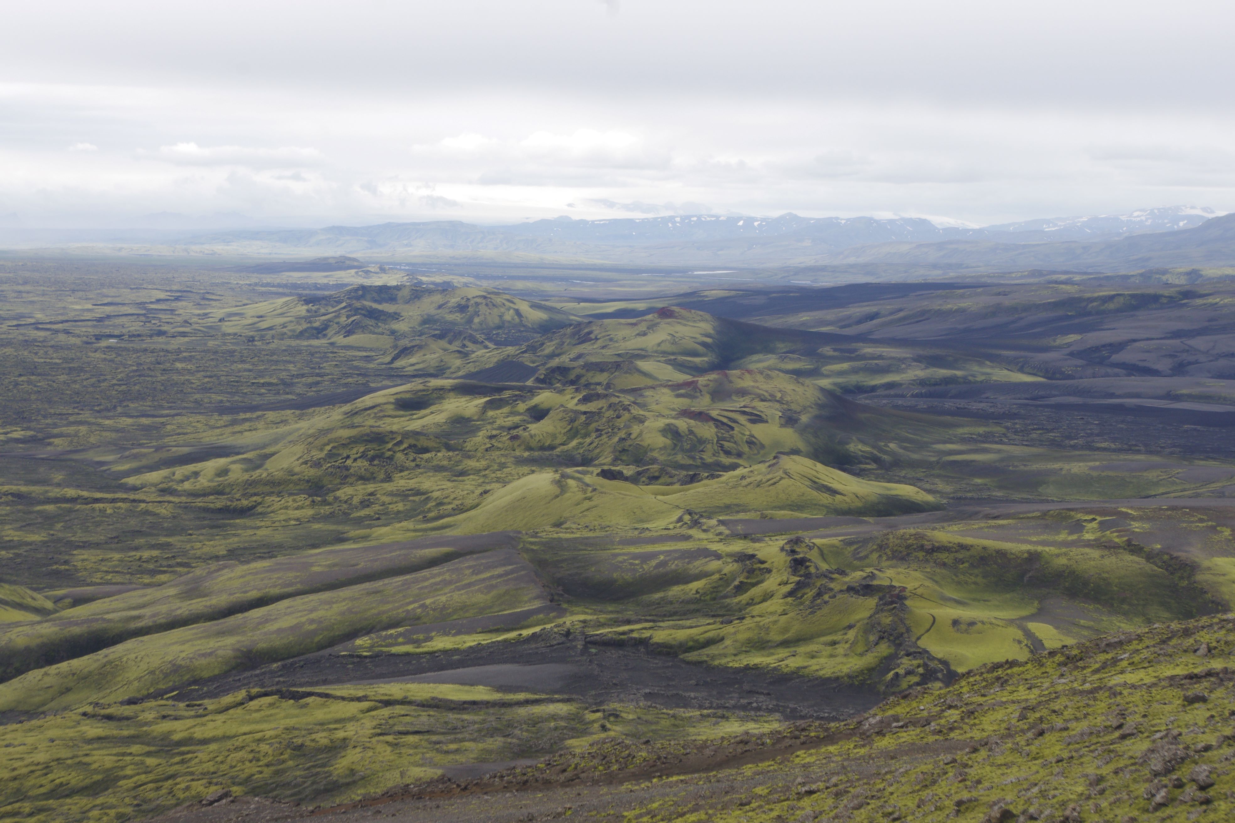
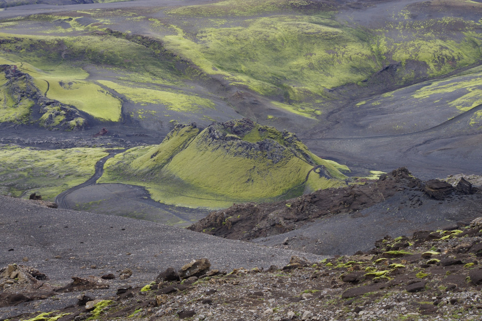
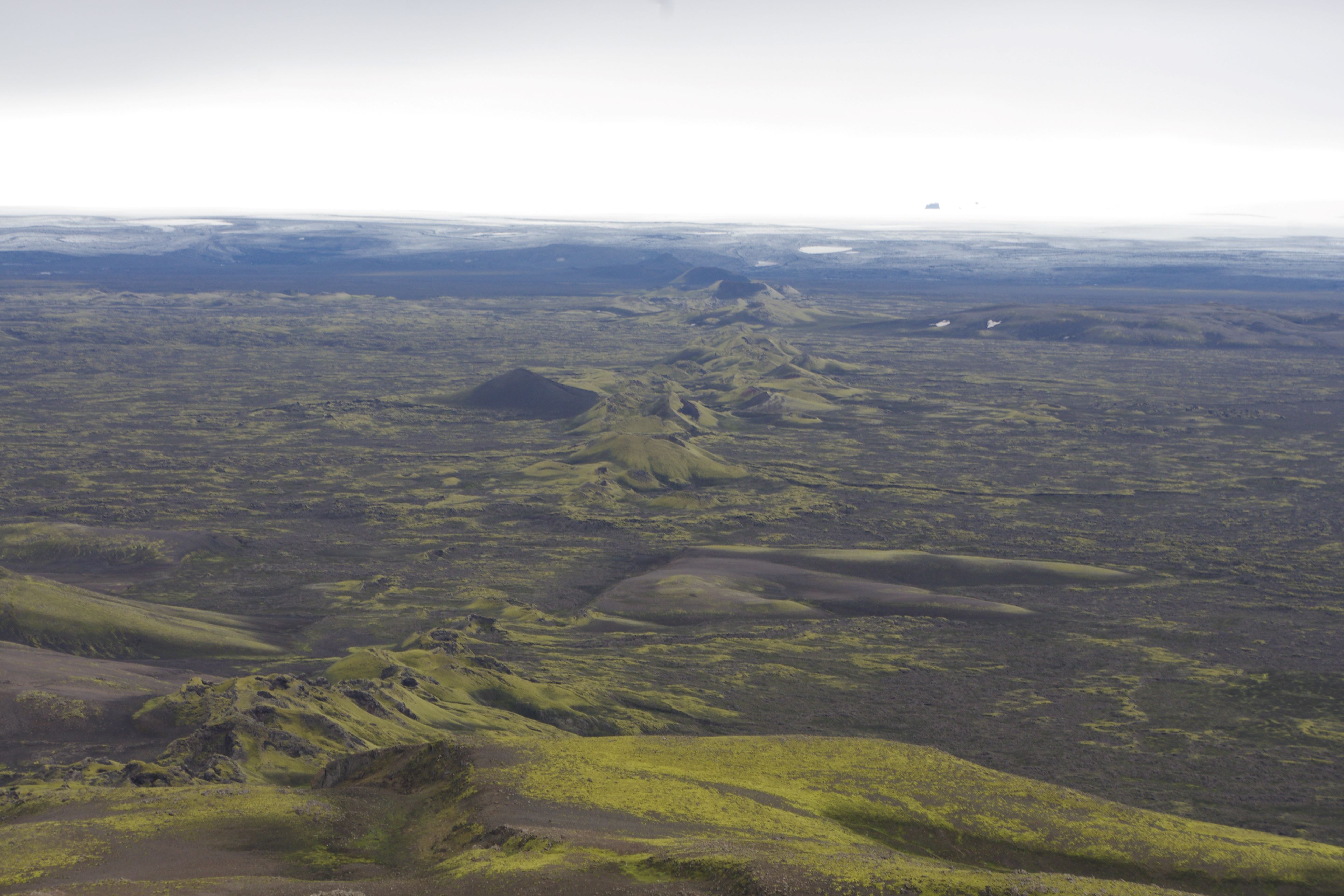
Lakagígar or Laki Craters is a 27 km long eruptive fissure consisting of 130 giant craters on the southwest side of Vatnajökull. An 8 month long eruption, which lasted from June 1783 til February 1784, was nothing short of catastrophic: 50%- 80% of livestock and 25% of the Icelandic population died.
The Laki eruption
On June 8, 1783 the Laki eruption (Skaftáreldar in Icelandic) of the Grímsvötn volcanic system commenced when a fissure segment opened by the hillock Hnúta about 13 km southwest of the mountain Laki. Over the subsequent 5 months the volcanic fissure lengthened to the northeast in nine discrete steps, where each step corresponded to an opening of a new fissure segment and start of a new eruption episode (10 in total). The total length of the volcanic fissure and the cone row constructed by the activity is 27 km. Up to six weeks prior to the onset of the eruption the inhabitants of the Fire Districts felt earthquakes which grew in intensity with time and were felt recurrently throughout the 8 months of activity. Each eruption episode began with a 0.5-2 day long explosive phase, discharging magma at the rate of 4,000 to 8,700 m³/s and sending ash-rich and gaseous plumes over inhabited areas with accompanying ash fall and lightning activity. Each explosive phases was followed by a longer-lasting (days to several weeks) lava producing phase discharging lava from the fissures at rates between 1,000 to 3,000 m³/s. For comparison, the magma discharge in the first days of the 1973 Heimaey eruption was about 100 m³/s.
The Haze Famine
The Laki eruption (Skaftáreldar) 1783-1784 and the resulting Haze Famine (Móðuharðindin) caused the worst environmental and socio- economic disaster in Iceland ́s history. The effects of the eruption reached far and the sulphuric aerosol cloud produced by Laki generated a persistent haze (dry fog) that hovered over large part of the northern hemisphere during the summer of 1783. On June 24th 1783, the haze was at its densest all over Europe. By the beginning of July it had spread to Russia, Siberia and China. At its peak, it covered about a quarter of the earth’s surface, or all land north of the 30° latitudinal line. It has been argued that the French revolution began with the eruption in Laki because of the enormous influence the mist had on the climate and farming in Europe.
Toxic ash ruined pastures so livestock got sick with a disease called gaddur, and starved. The weather cooled due to the mist, and sea ice reached the coast. When winter arrived in 1783–1784 livestock collapsed from starvation and disease due to the toxic volcanic material. People died of hunger. During the hardship one in five Icelanders (about ten thousand people) died, and around 75% of the farm animals were lost. In Fljótshverfi, Meðalland and Síða, about 40% of the population died, 20 farms were covered with lava and another 30 were badly damaged and had to be temporarily abandoned.
Celebrating Earth Heritage
How to visit the Katla Geopark
Katla UNESCO Global Geopark is in central South Iceland