Impressive 200m deep gorge
Markarfljótsgljúfur & Markarfljótsaurar
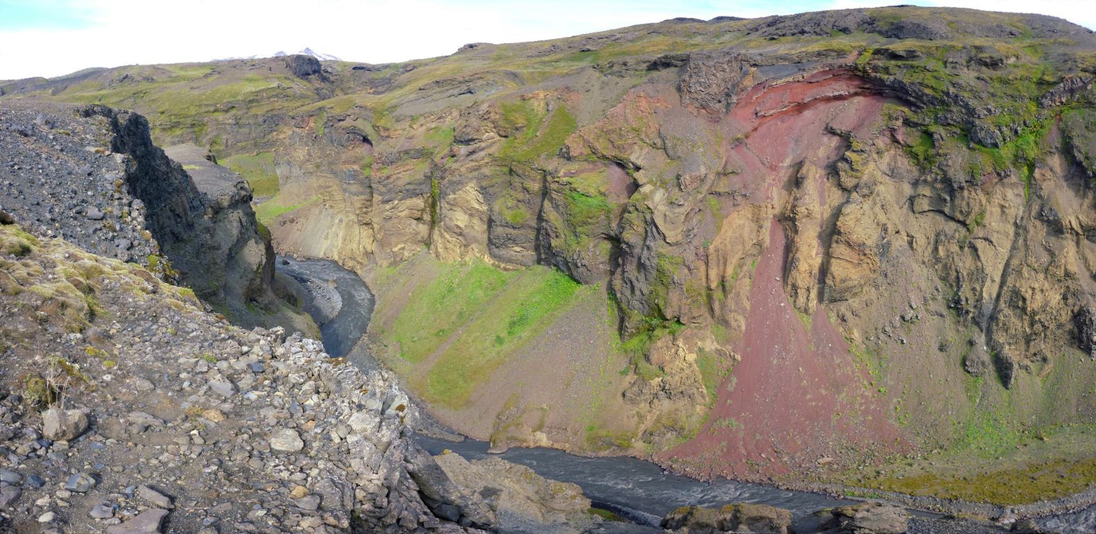
East of Tindafjallajökull Glacier lies the impressive 200m deep Markarfljótsgljúfur Gorge which was carved out the land by the Markarfljót River, one of South Iceland’s largest rivers. The 100km long river, whose main sources are located in Mýrdalsjökull and Eyjafjallajökull Glaciers, has an enormous 1200km2 catchment area. Markarfljót has carried millions of tons of sand and sediment down to the lowlands and out to sea, creating areas such as Landeyjarsandur and the land west of Eyjafjall. The riverbed deposit area from Markarfljót is known as Markarfljótsaurar.
Celebrating Earth Heritage
How to visit the Katla Geopark
Katla UNESCO Global Geopark is in central South Iceland