Eyjafjallajökull
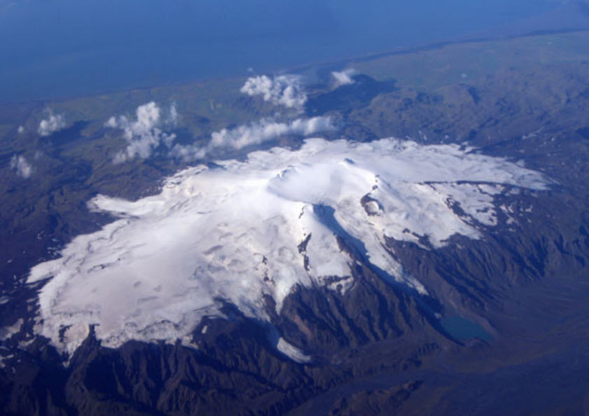
Eyjafjallajökull volcano is in the mountain range of Eyjafjöll and bears the same name as the glacier that covers parts of it. The volcano is ridge shaped, being elongated in an east-west direction and the highest point of it is 1651 m above sea level. The highest point is on the edge of the 2.5 km wide caldera of the volcano and the eastern part of the caldera can be seen from the view point. The system has been active for over 700.000 years and two short fissure systems extend from the caldera, one to the west and the other to the east in the direction of Katla Volcano. The Eyjafjallajökull volcano is partially covered by a glacier of the same name, which is the 6th largest glacier in Iceland and covers an area about 67 km2. The thickest parts are about 200-250 m and are within the caldera of the volcano. The caldera has an opening to the north, where Gígjökull outlet glacier flows out from it. The flanks of the volcano have been eroded heavily by glaciers and rivers, and wave erosion occurred on the west and the south sides at the end of the last ice age. The volcano is made out of layers of lavas, cube jointed basalt layers, and tuff layers, which can easily be seen at Þorvaldseyri viewpoint where the layering in Mt. Steinafjall is exceptionally beautiful. These alternating layers stem from the eruption history of the volcano, as it has been active while Iceland went through faces of glaciation and deglaciation. Eyjafjallajökull volcano has only four known eruptions during historical times, once during the 10th century C.E., then in either 1612 or 1613 C.E., in 1821–1823 C.E., and then famously in 2010 when it erupted and caused widespread disturbance to air traffic in Europe and across the Atlantic. The eruption in 2010 was preceded by a period of unrest, inflation, and seismic activity in 1994, 1999–2000, and in the days leading up to the eruption.
Celebrating Earth Heritage
How to visit the Katla Geopark
Katla UNESCO Global Geopark is in central South Iceland